
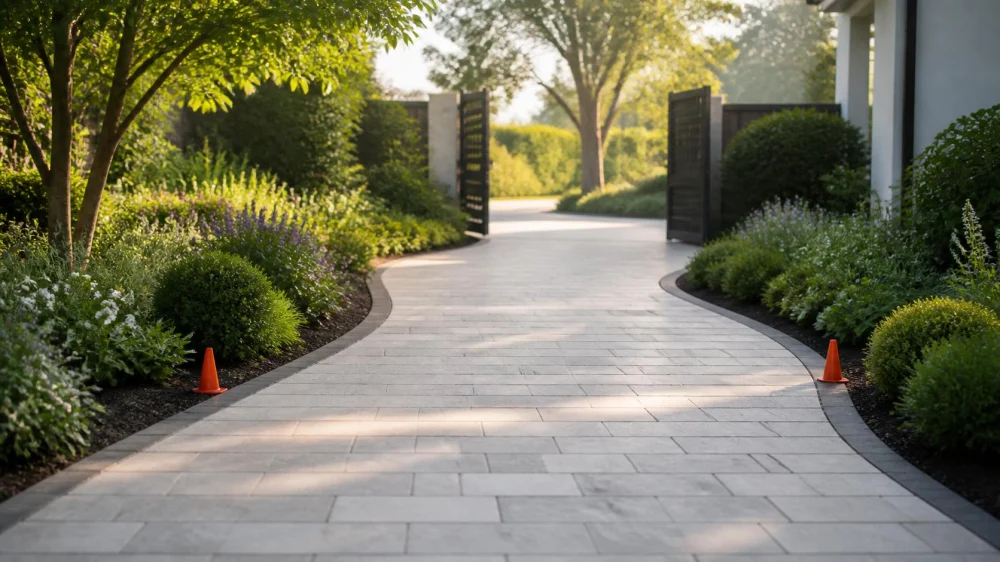
Garden Path Width: Plan Movement, Access, and Drainage
On this page
Quick answer
Choose a garden path width from the people and equipment that must use it, not from a single generic dimension. Mark doors, gates, turns, steps, slopes, planting spread, drainage routes, and places where users need to pass or pause. Test the route at full scale before construction, then confirm accessibility, permit, utility, and property requirements with the authorities and professionals responsible for the site.
Why path width is more than one measurement
A path may serve one walker, two people side by side, a wheelchair or mobility device, a stroller, garden cart, mower, trash bin, emergency access, or several uses at once. Its useful width can shrink at gates, handles, plants, edging, turns, and overhanging branches. Surface stability, cross-slope, transitions, drainage, and visibility affect whether that width actually works.
This guide is for residential landscape planning in the United States. It does not provide a universal code dimension or certify accessibility. Building, zoning, homeowners association, utility, easement, stormwater, fire, historic-district, and accessibility requirements vary by property, jurisdiction, and project scope.
Conditions to map before choosing a width
- Who will use the route, mobility devices, strollers, carts, bins, tools, pets, expected direction of travel, passing, resting, and seasonal use.
- Doors, gate swings, latches, thresholds, steps, ramps, landings, tight turns, wall projections, downspouts, meters, and utility access.
- Existing grade, longitudinal slope, cross-slope, low points, runoff, roof discharge, irrigation, soil, frost, erosion, and a lawful drainage outlet.
- Mature plant width, thorns, roots, trunk growth, pruning access, snow storage, leaf drop, lighting, sightlines, and overhead clearance.
- Surface material, joints, gaps, traction when wet, edge restraint, settlement, heat, glare, maintenance, repair, and expected service life.
- Property lines, easements, setbacks, underground utilities, tree protection, permits, inspections, and association review.
- Where users need to turn, pass, open a door, transfer, sit, set down a load, or move around a temporary obstruction.
Test and plan the path step by step
- Define the route's primary and occasional users, the largest equipment, and any accessibility or emergency function before drawing the path.
- Locate property, utility, drainage, tree, door, gate, grade, and permit constraints with current records and qualified help.
- Mark several candidate alignments and widths full size using removable stakes or tape that does not damage utilities or plants.
- Walk and roll the mock-up with representative equipment, testing gates, turns, passing points, stops, views, and links to doors or patios.
- Measure the clear usable width at the narrowest points, accounting for edging, handles, plant growth, walls, railings, and maintenance access.
- Select a stable surface and base system suited to soil, slope, drainage, climate, loads, transitions, and the intended level of accessibility.
- Document dimensions, grades, materials, drainage, edges, details, approvals, and maintenance, then verify the built route before final payment.
Save a dated site plan, photos, route purpose, clear-width measurements, slopes, door and gate details, passing or turning areas, surface and base specifications, drainage outlet, utility locate information, permits, product data, plant setbacks, contractor changes, inspection results, and maintenance instructions.
Code, slope, drainage, and material limits
A wider path does not correct an unstable surface, excessive slope, abrupt lip, unsafe stair, blocked landing, or drainage directed at a building or neighboring property. Permeable materials are not suitable everywhere and still require a designed base and outlet strategy. Do not excavate before utility locating, alter protected roots casually, or assume a private residential path is exempt from every rule.
Use a qualified landscape designer, architect, engineer, accessibility specialist, arborist, drainage professional, or contractor when the route involves steep grade, retaining walls, stairs, structural loads, public access, protected trees, complex drainage, or legal compliance. Stop work for an unmarked utility, unexpected void, unstable soil, flooding, wall movement, or another immediate hazard, and contact the responsible authority or emergency service.
Frequently asked questions
What is the standard garden path width?
There is no single width for every route. Users, equipment, passing, turning, accessibility goals, gates, codes, and site constraints determine the needed clear width.
Should the whole path have the same width?
Not always. A route may use wider passing, turning, landing, or gathering areas, but narrow points still need to work for the intended users.
Do plants count against path width?
Yes when foliage, thorns, trunks, roots, or seasonal growth intrude into the clear travel area. Plan from mature size and maintenance reality.
Is gravel an accessible surface?
Performance depends on material, compaction, containment, slope, maintenance, and applicable standards. Ask a qualified professional for the specific accessibility goal.
How should a path handle rainwater?
Its grades, surface, base, edges, and outlet should manage water without sending it toward structures, creating erosion, or shifting a problem elsewhere.
Sources and evidence
Use the local building, zoning, public works, stormwater, fire, and accessibility authorities for applicable requirements. Use utility locating services before excavation, recorded property documents for boundaries and easements, and product manufacturers for installation data. A qualified site professional should reconcile those sources with measured grade, soil, drainage, vegetation, and intended use.
Conclusion and next steps
List every user and load, map the fixed constraints, and mock up the route at full scale before choosing a width. Judge the narrowest clear points together with slope, surface, turns, drainage, and maintenance. Then document the approved design and verify what was built. A useful path feels obvious in motion because the difficult decisions were tested before construction.





 Schultz Lawn Care4.0 (432 reviews)
 Walmart Patio & Garden Services0.0 (0 reviews)
 Brightwood Landscape and Snow Removal5.0 (5 reviews)
 Modern Lawn and Landscape LLC5.0 (11 reviews)
 C & B Landscaping, LLC5.0 (7 reviews)
 A.R.N Landscaping Enterprises LLC5.0 (1 reviews)
 How to Landscape With Ornamental Grasses
 How to Use Native Trees to Boost Property Value
 How to Shape Garden Bed Edges for Easier Mowing
 How to Prevent Soil Erosion Naturally Without Retaining Walls
 How to Use Moss and Groundcovers for a Woodland Feel
 How to Maintain Your Garden Tools for Longevity