
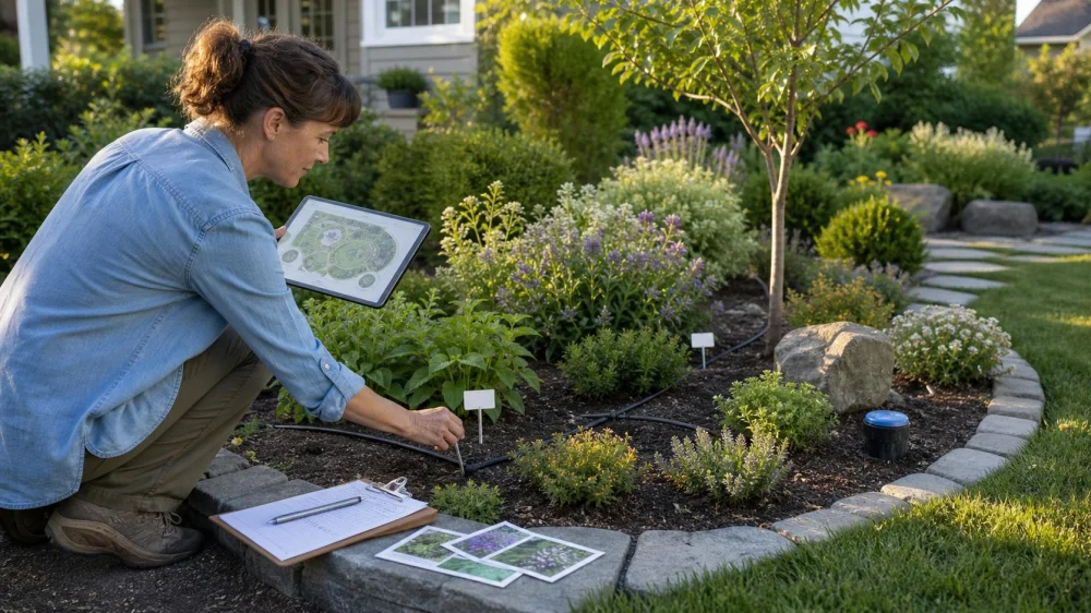
Landscape Plant Map: Label Beds, Trees, and Irrigation Zones
On this page
Quick answer
Draw the property outline and permanent features, divide planting areas into named zones, and assign every tree, shrub, perennial group, and important groundcover a short unique identifier. For each ID, record the verified botanical and common name, cultivar, planting date, source, mature size, light and soil notes, irrigation zone, care instructions, warranty information, and dated photos.
Put weather-resistant labels where they can be found without creating trip, mower, or tree-girdling hazards. Keep the detailed record digitally and a simplified copy with the property documents. Update it whenever plants, irrigation, hardscape, or maintenance responsibility changes.

Choose a simple base map
Start with an aerial image, survey, landscape plan, or a hand sketch measured from permanent reference points. Mark the house, property edges, driveway, walks, fences, gates, decks, utilities, major slopes, drains, outdoor faucets, irrigation equipment, and established trees.
Divide the landscape into names that make sense during a phone call: front entry bed, northwest foundation bed, mailbox island, rear patio border, east slope, or street tree strip. Avoid labels such as “bed one” unless the number is also posted or mapped clearly.
The map does not need survey precision for ordinary care, but do not use it to locate buried utilities or property boundaries for digging. Contact the official utility-marking service and qualified professionals before excavation.
Fast Blade Lawn Care & Landscape LLC.
200 N 28th St lot15, Fairfield, IA 52556, USA
Give each plant a stable identifier
Create short IDs that stay the same even when the plant's name is corrected. For example, T-01 can mean the first mapped tree, S-07 a shrub, and P-12 a perennial group. Keep a legend so future owners or contractors understand the code.
Map individual trees and large shrubs separately. For masses of identical small plants, map the group boundary, original quantity, spacing, and ID rather than labeling every stem. Split the group later if different replacements or conditions develop.
Do not reuse an old ID for a new plant. Mark the old record as removed, with date and reason, then give the replacement a new ID. This preserves the history behind warranty, pest, drainage, and performance questions.
Record the details that change decisions
Attach useful facts to each plant or group:
- botanical name, common name, cultivar, and verification source;
- quantity, container or caliper size at planting, installer, and purchase date;
- expected mature height and width from a reliable regional source;
- sun exposure, soil or drainage observations, slope, and nearby structures;
- irrigation method and controller zone;
- mulch, staking, pruning, fertilization, and seasonal care notes;
- warranty terms, receipt, tag photo, and claim contact;
- dated photos of normal growth, stress, damage, treatment, and replacement.
Separate verified facts from observations. “Yellow leaves appeared after three rainy weeks” is more useful than writing an unconfirmed diagnosis.
Connect plants to irrigation zones
Run each irrigation zone manually with the contractor or controller instructions and mark the heads, emitters, valves, and approximate coverage. Note mixed zones where turf, trees, shrubs, and drought-tolerant plants receive the same schedule.
Record the controller station, not just “drip.” A future technician needs to know which valve operates the bed. Photograph valve boxes and reference them to permanent landmarks without publishing the map publicly.
The map does not determine watering frequency by itself. Weather, soil, plant establishment, root depth, slope, emitter output, restrictions, and season matter. Use the map to ask a qualified professional better questions and to find mismatches.
Use durable outdoor labels
Choose UV- and weather-resistant labels appropriate for the setting. Place them low enough to stay discreet but visible enough for maintenance. Keep labels away from mower paths, play areas, walkways, pets, and sharp exposed stakes.
Never tighten wire, plastic, or a rigid tag around a growing trunk or branch. It can become embedded or girdle the plant. Use a separate stake with safe clearance or a loose system designed and checked for growth.
A QR code can link to a private record, but include the short ID in human-readable form too. Digital services can expire, phones may lack signal, and public codes can expose property information.
Update the map after every change
Set a routine: spring walk-through, midseason irrigation check, autumn photo set, and update after every installation, removal, transplant, major prune, irrigation repair, storm, or warranty visit.
Keep versions by date rather than overwriting the only copy. Save invoices, plans, utility confirmations, soil tests, care sheets, and contractor reports in folders that use the same plant IDs.
When hiring maintenance, give the crew a task-specific copy rather than every private property record. Mark plants not to prune, recently treated areas, new transplants, irrigation problems, and access limits.
Frequently asked questions
Do I need the Latin name?
The botanical name and cultivar can distinguish plants that share a common name and can improve care research. Keep the common name too.
What if I cannot identify a plant?
Assign an ID, take clear seasonal photos, and mark the name unverified. Ask a local extension office, qualified horticulturist, arborist, or nursery.
Can I map plants with a phone app?
Yes, if you can export and back up the data. Avoid a system that traps the only copy in a discontinued service.
Should I include weeds and volunteer plants?
Map recurring or important ones when they affect management. Do not treat an unknown plant until it is identified and the control method is appropriate.
Who gets the map when I sell the property?
Consider transferring a privacy-reviewed copy with landscape plans, irrigation information, warranties, and care records.
Limits and professional help
A landscape map is an operations record, not a survey, utility locate, irrigation design, diagnosis, or tree-risk assessment. Hire appropriate professionals for boundary questions, excavation, electrical work, backflow devices, major drainage, structural roots, hazardous trees, and pesticide decisions.
Plant names and mature dimensions can be wrong on old tags or generic websites. Verify with regional extension resources, the grower, a recognized plant database, or a qualified local professional.
Next steps
Sketch the permanent property features, name every bed, and map the ten largest plants first. Add short IDs, photograph tags, and connect each bed to an irrigation station. Then fill in small plants over several walks and schedule a quarterly reminder to keep the map current.


 Chepe Landscaping and Snow Removal4.0 (8 reviews)
 Area Landscape Supply Inc4.0 (83 reviews)
 Walmart Patio & Garden Services0.0 (0 reviews)
 Henry Home and Yard4.0 (31 reviews)
 Knepp Sand & Stone Co4.0 (83 reviews)
 Lawndale Landscaping5.0 (19 reviews)
 How to Use Shade Trees to Lower Cooling Costs and Improve Home Efficiency
 How to Build an Outdoor Kitchen That Fits Into Your Garden
 How to Create a Landscape That’s Easy to Clean and Maintain
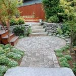 How to Use Paving Patterns to Define Outdoor Rooms and Transform Your Landscape
 How to Plan Outdoor Fire & Water Features Harmoniously
 How to Build and Maintain a Backyard Pond