
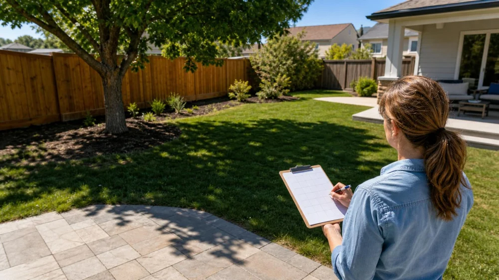
How to Map Sun and Shade Before Planning Your Landscape
On this page
Quick answer
Map sun and shade by sketching the property, then marking direct light at regular times from morning through late afternoon on a clear day. Note buildings, trees, fences, slopes, and reflected heat. Repeat in another season because the sun path and deciduous canopy change. Use total direct-light hours, timing, heat, soil moisture, and regional climate together; a single “sunny” or “shady” label is not enough for reliable plant or patio placement.
A landscape sun map is a site plan that records where direct sunlight, filtered light, and building or tree shade occur at different times and seasons.
Landmark Landscapes Inc
Green LakeGreen Lake CountyWisconsin
601 Commercial Ave, Green Lake, WI 54941, USA
Why a sun map matters
Light influences flowering, leaf color, water use, soil temperature, snow melt, outdoor comfort, and how long surfaces remain wet. Two areas that each receive four hours of sun can perform differently if one receives gentle morning light and the other intense late-afternoon heat.
A map helps prevent expensive relocation of trees, shrubs, vegetable beds, turf, play areas, and patios. It also makes conversations with a landscaper more specific: instead of saying “the backyard is shady,” you can show when, where, and why.
What to prepare
- A simple property sketch or printed aerial base with north marked.
- House walls, roof overhangs, fences, sheds, large trees, slopes, and neighboring structures.
- Colored pencils or separate tracing sheets for each observation time.
- A phone camera and alarm for consistent records.
- Notes for weather, date, and unusual temporary shadows.
The drawing does not need survey accuracy for an early concept, but property lines, utilities, easements, drainage, and permit decisions require authoritative records and professional location services.
A one-day observation method
- Start shortly after sunrise. Shade the areas receiving direct light and outline deep building shade separately from filtered tree light.
- Repeat every two hours. A practical schedule is 8 a.m., 10 a.m., noon, 2 p.m., 4 p.m., and 6 p.m., adjusted for season and daylight.
- Photograph from fixed points. Use the same view and include enough landmarks to compare shadow movement.
- Note intensity and heat. Record reflected light from pale walls, pavement, pools, windows, or south- and west-facing surfaces.
- Add up direct-light periods. Create zones for long sun, partial sun, brief sun, filtered light, and consistent shade without assuming universal hour cutoffs.
- Check soil conditions. Note areas that remain damp, dry quickly, receive roof runoff, or compete with major roots.
Observe from the ground; do not climb a roof or unstable ladder to improve the map. Be aware that a neighboring vehicle, open umbrella, or temporary structure may distort one reading.
Account for seasonal change
The sun is higher and days are longer in summer; winter light arrives at a lower angle and may be blocked by buildings or evergreen trees. Deciduous trees can create deep summer shade while allowing winter sun through bare branches.
For a major project, repeat the map near different seasons or use observations plus a reputable sun-path tool. Photographing at least once during leaf-on and leaf-off conditions is especially helpful. Also consider whether young trees will expand their canopy and whether planned construction will create new shade.
A one-day map is best for an initial design. It is not ideal as the sole basis for a costly greenhouse, solar feature, pool, mature tree, or highly light-sensitive planting.
Turn observations into design decisions
- Outdoor seating: choose morning sun for cool climates or breakfast use; provide afternoon shade where summer heat is a concern.
- Vegetable and flower beds: match actual direct-light timing to the crop or plant guidance for your region.
- Trees and shrubs: account for mature canopy, roots, buildings, utilities, and how new shade will affect nearby plants.
- Turf alternatives: persistent shade and root competition may favor mulch, paths, shade-adapted groundcover, or another surface over struggling lawn.
- Water planning: group plants with similar light and moisture needs instead of compensating for poor placement with extra irrigation.
- Windows and comfort: consider views, privacy, glare, winter warmth, and summer heat before placing tall evergreen screening.
Use the map with the USDA hardiness zone, local heat and humidity, soil test, drainage, deer or pest pressure, and plant-specific mature size. Country-level guidance cannot choose plants for every United States climate.
Common mistakes and limitations
- Observing only at noon and missing long morning or afternoon shadows.
- Mapping in winter and forgetting that trees will leaf out.
- Counting bright indirect light as direct sun.
- Ignoring reflected heat from walls, rock, pavement, or glass.
- Choosing plants by a generic “full sun” tag without checking regional nursery or extension guidance.
- Designing around a tree without considering its health, ownership, mature spread, or removal risk.
Clouds make light harder to classify, so repeat uncertain observations. A phone light meter is not necessary for basic planning and may give inconsistent readings without calibration.
Sources and evidence notes
This method reflects common landscape site-analysis practice: observe existing conditions, track solar exposure over time, document seasonal constraints, and match plants and uses to the site rather than forcing the site to a fixed concept. Plant-light terms and recommended hours vary by source and climate, so local Cooperative Extension, botanical garden, or reputable nursery guidance should inform final selections.
Frequently asked questions
How many hours count as full sun?
Many plant references use roughly six or more hours of direct light, but definitions and plant tolerance vary. Afternoon heat can be more stressful than the same duration of morning sun. Follow guidance for the specific plant and region.
Can I make a sun map in one day?
Yes, for a useful starting point on a clear day. Repeat in a different season and after major canopy or building changes before making expensive permanent decisions.
Does dappled light count as shade?
Record it as filtered or dappled light rather than forcing it into a binary category. Plant performance depends on canopy density, duration, climate, and the species involved.
Which direction gets the hottest sun?
In much of the Northern Hemisphere, west-facing areas receive strong late-day heat, while south-facing areas often receive substantial sun. Buildings, terrain, latitude, and trees can change the actual pattern, so observe the property.
Should I map neighboring trees?
Yes, when their current or future shade reaches the site. Do not assume you can prune or remove a tree you do not own; property and tree rules vary locally.
Next steps
Draw the property outline, mark north, set six observation alarms for the next clear day, and photograph from two fixed locations. Combine the time layers into practical light zones, then use those zones with soil, drainage, climate, and mature plant size to brief a landscaper or build a planting plan.

 R&A's Landscaping LLC0.0 (0 reviews)
 S & S Landscaping & Nursery4.0 (50 reviews)
 DC's Lawn and Landscape4.0 (3 reviews)
 Sugar Creek Stone4.0 (15 reviews)
 MGA Services, Inc4.0 (10 reviews)
 Krueger Landscape Services LLC0.0 (0 reviews)
 How to Prep Your Yard for a Landscape Makeover
 How to Cultivate a Wildflower Meadow at Home: A Step-by-Step Guide
 How to Design a Family-Friendly Backyard Without Losing Style
 How to Create a Butterfly Pathway Through Your Garden: A Step-by-Step Guide
 How to Create a Garden That Thrives in Shade
 Water Features That Don’t Kill Your Budget: Smart Backyard Ideas